
Where Pittsburgh
comes outside.
A 2011 website, reimagined for today.
Chris originally built a website for Friends of the Riverfront in 2011. This redesign brings that work forward with a simpler way to discover the trails, plan a visit, and connect with the riverfront.
Strategy • Design • Development • Interactive mapping
Explore the websiteFRIENDS OF THE RIVERFRONT / HOMEPAGE

The idea
Make the first step
feel easy.
A riverfront trail can be many things: a commute, a quiet walk, a family outing, or a place to lend a hand. The website should help someone move from “I’d like to go” to “I know where to start.”
The experience starts with visitor questions: Where can I go? How do I get there? What should I know before I leave?
A closer look
See the full design.
Explore the desktop and mobile experiences in context. Open a capture to inspect it at full size.
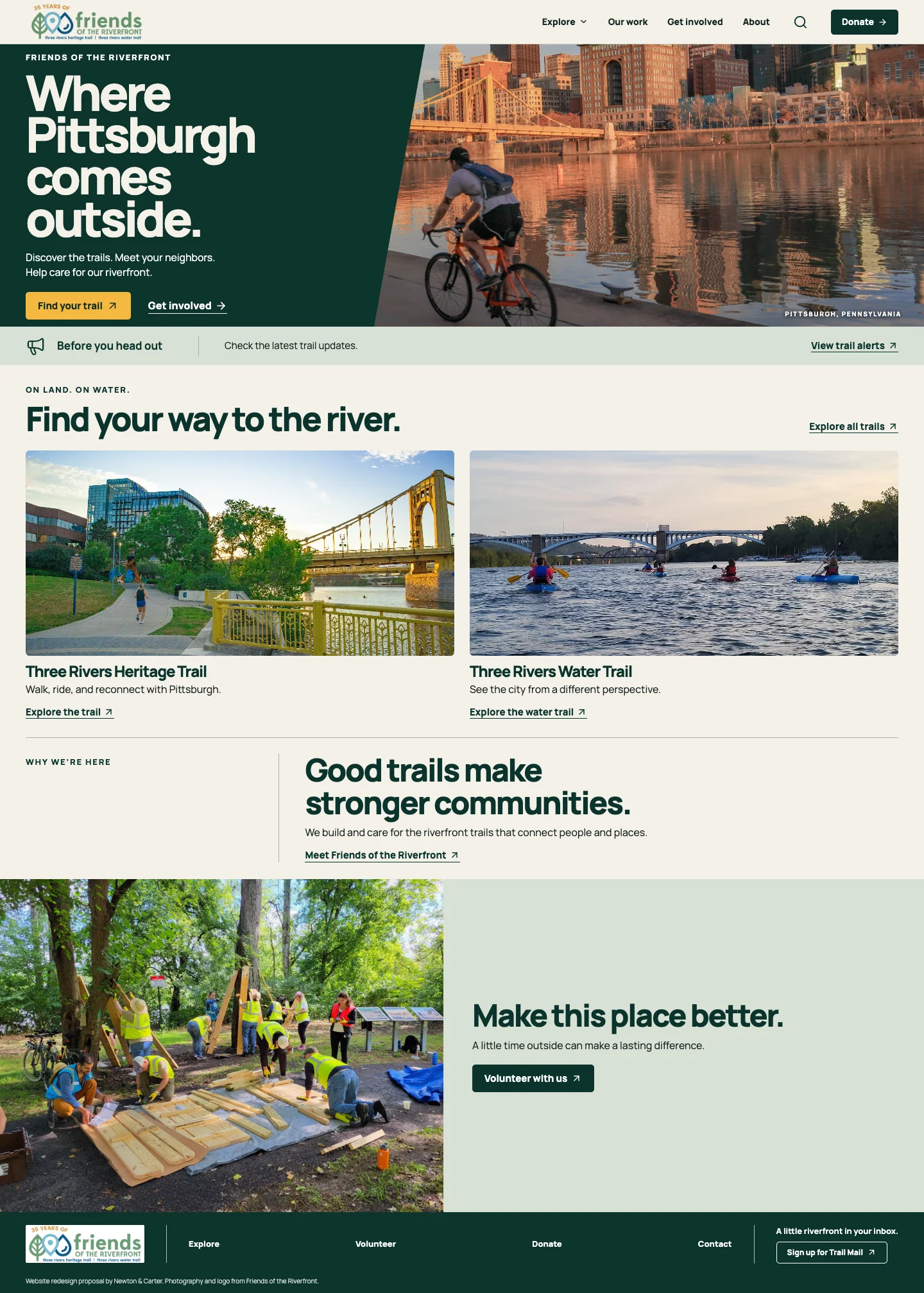
Mobile experience
Homepage on a phone.
See how the same experience adapts to a smaller screen.

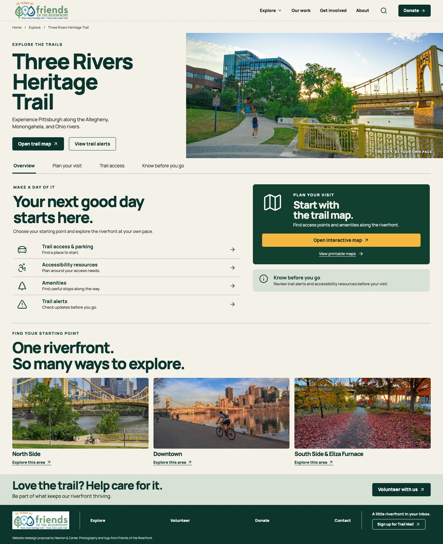
Mobile experience
Trail guide on a phone.
See how the same experience adapts to a smaller screen.

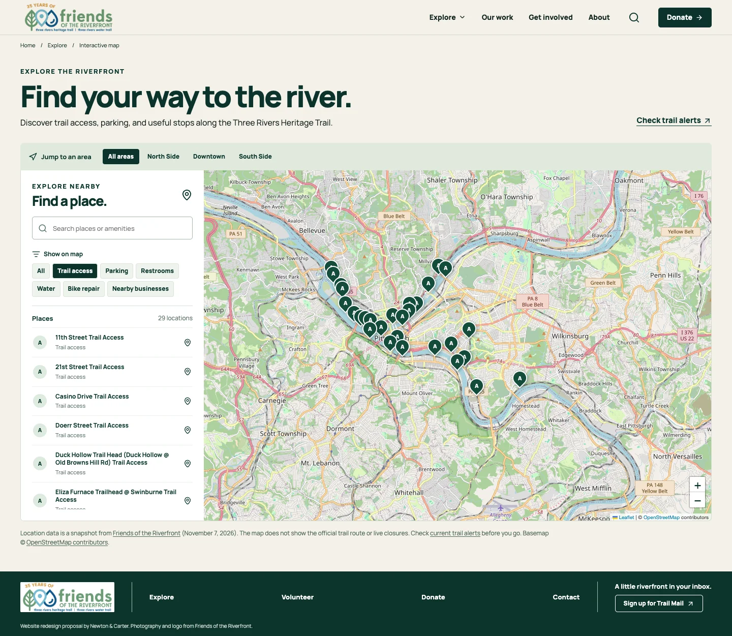
Mobile experience
Interactive map on a phone.
See how the same experience adapts to a smaller screen.
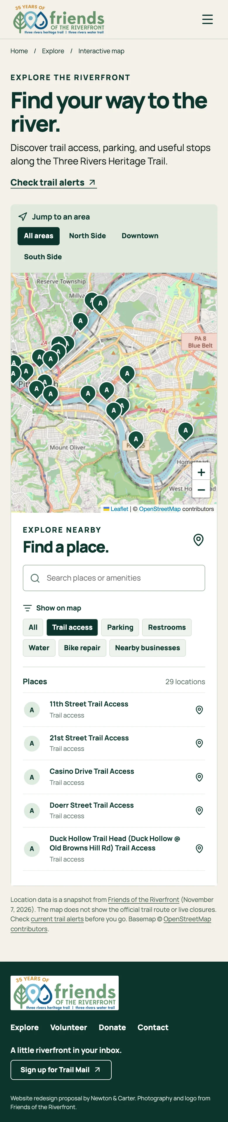
The experience
A better welcome
to the river.
A connected experience that makes the riverfront easier to discover, navigate, and enjoy.


The thinking
Designed around
real decisions.
Lead with the destination.
The homepage makes land and water trails visible immediately. Visitors can follow their interest before they need to understand every program or page.
Turn the map into a starting point.
Area shortcuts, search, amenity filters, and a readable list help people find access points without relying on a map alone. The map links to official alerts because its locations are a snapshot.
Connect planning with participation.
Trail access, accessibility resources, alerts, volunteering, and the organization’s work sit within the same experience, helping a visit become a longer relationship with the riverfront.
Looking ahead / AI-assisted exploration
A smarter way
to find your way.
The next opportunity is to make the map more conversational. An optional assistant could translate a visitor’s needs into useful filters and point them toward relevant, verified information.
AI-assisted search is a proposed future feature.
“Where can I park near a trail access point?”
The assistant could surface matching parking and access points, link to their sources, and flag when information needs to be checked.
ILLUSTRATIVE RESPONSEStart with the question.
Turn a request into explicit filters for area and amenities. Ask a follow-up when the person’s starting point or needs are unclear, and let them adjust the filters.
Show the evidence.
Search maintained trail and amenity records using spatial queries, then show source links, update times, and official alerts. Say when a detail is missing or stale.
Keep people in control.
Use verified route data for directions; never guess distances, accessibility, or current conditions. Ask before using location, and keep ordinary map controls available.
See it for yourself
Good trails bring
people together.
Explore the website, from the homepage to the map.